_MENU")
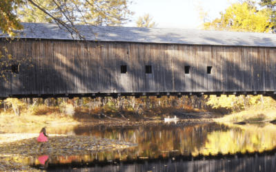
Be sure at least one of these hikes is on your itinerary for your trip to Maine and the Mount Washington Valley
You can find trail information for all of our recommended trails on our Top 10 List at AllTrails, Click Here.
Jockey Cap
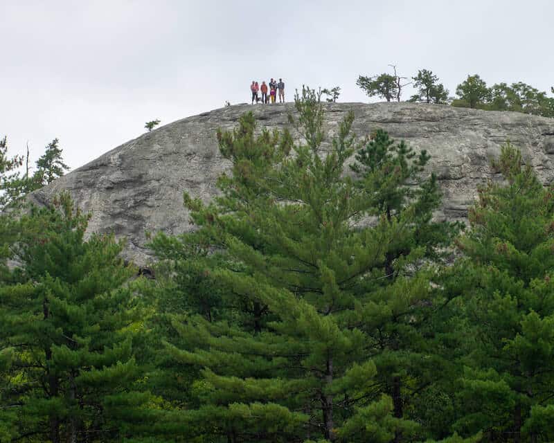
Hiking Length: 0.8 mi round trip
Hiking Difficulty: Easy
Elevation Gain: 170 ft
Peak Elevation: 600 ft
Distance from The White Gables Inn: 1 mile
Our take: This giant rock formation was deposited in Fryeburg by glaciers and looms large over the town. The area was of significance to the native Pequawket tribe and it is said that one native, Molly Ockett whom the local grade school is named after, lived in the cave near the base of the rock formation. A short hike will bring you to the top with its 360o views and a really cool monument in honor of Admiral Perry that will help you identify all the surrounding mountains. Jockey Cap is also popular with rock climbers due to its bouldering, many cracks, slab routes, and face climbing options.
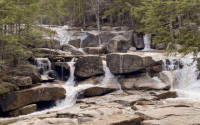
Diana’s Bath
Hiking Length: 1.3 mi (total out and back to beginning of falls, many options for extending the hike)
Hiking Difficulty: Easy
Elevation Gain: 114 ft
Distance from The White Gables Inn: 14 miles
Our take: A gentle 0.6 mile on a well-maintained trail will take you to Lucy Brook and its seemingly endless cascade of small waterfalls. You can continue to walk up the trail or forge your own over and across the rocks and small pools. In the summer months, bring you bathing suit and take a dip in the pools and waterfalls. Not only is the scenery absolutely stunning, it truly is fun for the whole family. Note: The parking lot is small compared to the demand. Going off season, early in the morning, late in the afternoon, or finding a ride service like an Uber or taxi (we can help with options) can save you a potentially frustrating parking experience.
You can read more in our detailed blog post here
Sabattus Mountain
Hiking Length: 1.3 mi
Hiking Difficulty: Easy
Elevation Gain: 488 ft
Peak Elevation: 1,253 ft
Distance from The White Gables Inn: 16.1 miles
Our take: Sabattus Mountain is one of our favorite hikes, and thus why we named one of our guest rooms after it. A loop of 1.4 miles takes you to the summit where you can view the White Mountains surrounded by wild flowers. There is even a memorial bench to allow you to enjoy the view in comfort.
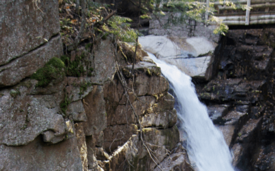
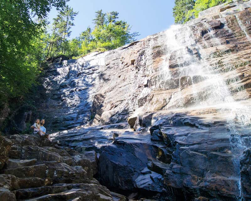
Arethusa Falls
Hiking Length: 2.8 mi
Hiking Difficulty: Moderate
Elevation Gain: 784 ft
Distance from The White Gables Inn: 31.4 miles
Our take: This steeper hike is well worth the effort with views of the 2nd tallest waterfall in New Hampshire at 140 feet. You are able to walk up to the granite cliffs and stand at the base of the falls. The Bemis Brook trail includes a steeper route to/from Arethusa Falls but also provides opportunities to walk along the Brook and enjoy many smaller falls and pools.
You can read more about the falls and the hike at our blog post here.
Black Cap
Hiking Length: 2.3 mi
Hiking Difficulty: Moderate
Elevation Gain: 610 ft
Peak Elevation: 2,369 ft
Distance from The White Gables Inn: 8.2 miles
Our take: Black Cap Trail is located just outside of North Conway. This moderately difficult short hike is very popular. The summit provides excellent views of the White Mountains and the Mount Washington Valley.
Mount Chocorua
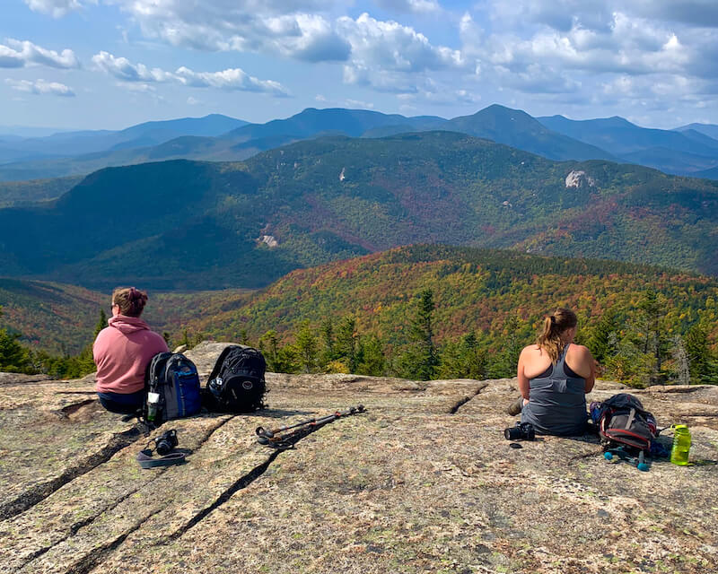
Hiking Length: 7.4 to 8.6 mi
Hiking Difficulty: Moderate
Elevation Gain: 2,244 to 2,700 ft
Peak Elevation: 3,500ft
Distance from The White Gables Inn: 15.2 miles
Our take: This is one of the most photographed and popular peaks in the White Mountains and for good reasons. The mountain with it’s clear, rocky top is perched high above Lake Chocorua and is worthy of a painting. There are two trails we would recommend, the Piper Trail with the trailhead located right off of Rt 16, and the Champney Brook Trail, which as you get from the name runs along the water. Great year round and enhanced by the fall foliage.
Pleasant Mountain
Hiking Length: 4.7 mi to 5.4 mi
Hiking Difficulty: Moderate
Elevation Gain: 1,528 to 1,984 ft
Peak Elevation: 2,006 ft
Distance from The White Gables Inn: 11 miles
Our take: Pleasant Mountain is the home of Shawnee Peak ski area. There are two main trails that take you to the summit, the Southwest Ridge Trail is the more heavily trafficked of the two, though the Fire Warden’s Trail is shorter.
North & South Baldface Mountains
Hiking Length: 9.8 mi
Hiking Difficulty: Hard
Elevation Gain: 3,600 ft
Peak Elevation: 3,750 ft
Distance from The White Gables Inn: 16.7 miles
Our take: We are surrounded by beautiful hikes, but this is Mike’s favorite. Do you like a good challenge, 4 miles of amazing open views above the tree line, some scrambling, wild blueberries, and crystal-clear stream crossings including Emerald Pool, a picture perfect swimming hole where you can cool off after a long day? Of course you do, so let’s go!
You can read all about Mike’s last trek up the mountains here.
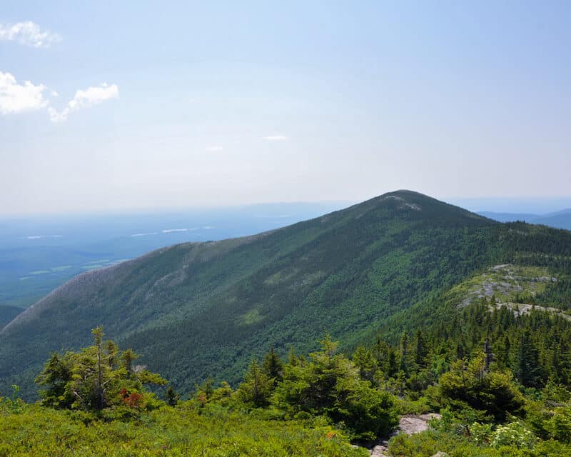
Kearsarge North
Hiking Length: 6.2 mi
Hiking Difficulty: Hard
Elevation Gain: 2,600 ft
Peak Elevation: 3,268 ft
Distance from The White Gables Inn: 13.6 miles
Our take: Great views of this mountain are found throughout the area including from right here on the property. This is one of Mike’s favorites hikes and certainly his most nostalgic. When Mike hiked this as a kid, his mom went out every 15 mins with a mirror and flashed it in the sunlight towards the peak of the mountain so Mike could see where his house was. A truly enjoyable hike leads to 360o views including an accessible fire tower with logbook.
Mount Washington
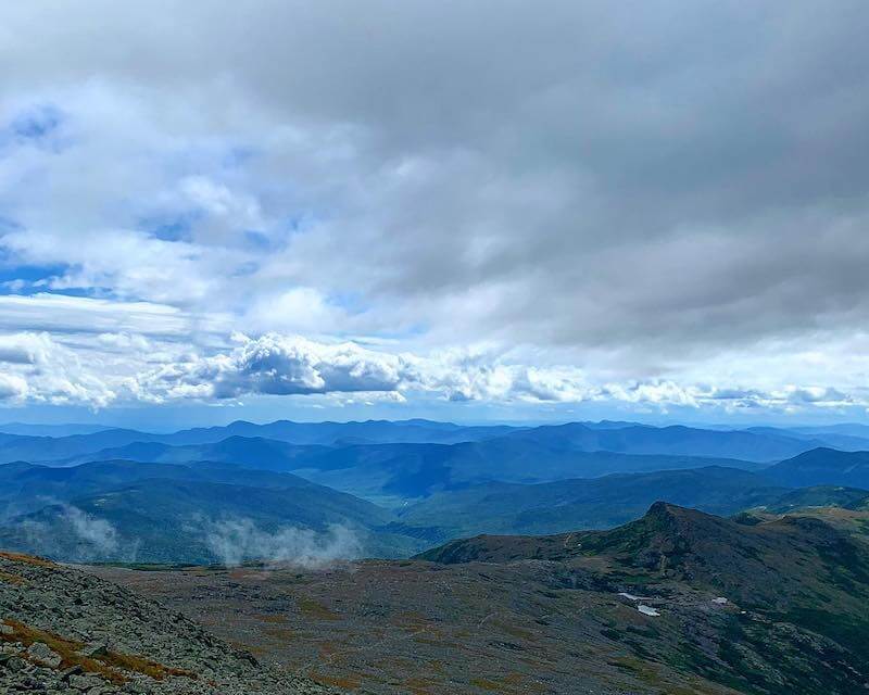
Hiking Length: 7.9 mi to 9.8 mi
Hiking Difficulty: Hard
Elevation Gain: 4,169 to 4,799 ft
Peak Elevation: 6,288 ft
Distance from The White Gables Inn: 28.8 miles
Our take: The tallest mountain in the Northeast, Mount Washington, called Agiocochook by some Native American tribes, is visible throughout the area. It is a difficult hike where you need to be prepared for all kinds of weather year-round when you reach the summit. And just ignore all those people getting out of their cars at the peak, you earned that view!
You can find trail information for all of our recommended trails on our Top 10 List at AllTrails, Click Here.