_MENU")
aka Mikes Favorite Hike
Hiking Summary
Summit: South and North Baldface Mountains
Elevation: 3,000 Mountains
Trail Name: CircleTrail
Miles: South and North Baldface Mountains
Time: 4 hours
Two of the things I most looked forward to when we decided to move back to Fryeburg, besides returning to whoopie pie country (if you are unfamiliar with whoopie pies, google them immediately then get up here ASAP and stop denying yourself one of life’s greatest pleasures), were showing my friends from Massachusetts all that the Fryeburg area had to offer and being at the foot of the White Mountains. When one of my co-workers and closest friends Natalie said she wanted to stay with us for 4-5 days, I was pretty pumped. When she then said she wanted to hike the Baldface Mountains, my personal favorite hike, I was outright euphoric.
Additionally, Natalie had only seen a moose once in her life and had challenged me to find a moose with her. Challenge accepted! Subsequently on the day of the hike, we left The White Gables Inn extra early so that we could stop by a top secret moose lookout prior to starting the hike. After arriving at the location I untied Natalie’s hands and took the bag off her head (I did say it was top secret). Though somewhat distant and camera shy, we did find a female moose and declared the moose hunt a success.

We reached the parking lot/trailhead around 7:30 AM and our hike had begun. We chose to do the Baldface Circle Trail which is a 9.8 mile loop that allows you to summit both the South and North Baldface Mountains. I recommend doing the South summit first (go clockwise around the loop) due to it being the steeper trail that has quite a few ledges and requires some scrambling. i.e. I enjoy climbing up it, not down it.
We put on a fairly aggressive pace and had reached the Baldface shelter and camping sites about 1 hour and 15 mins into the hike. This a great spot to take a break or even spend a night, though not nearly as great as spending the night at The White Gables Inn…obviously.

This is also your last chance to enjoy some sustained shade. If the name didn’t give it away, the majority of the Bald Face Circle Trail takes place above the tree line. This means you will be treated to fantastic views for the majority of your day, but it also means you should come equipped with sunscreen and plenty of water. After leaving the shelter and emerging out of the tree line you will encounter the most difficult part of the hike; the ledges up South Baldface. This will require use of both hands and feet as you have to scramble up and over rock formations spread across several tenths of a mile.
Having climbed up and over the most difficult section of ledges we took another short break and took in some of the views. While Natalie was enjoying the rest of her snack, I decided to make a small cairn to mark the way.

Unfortunately, still being relatively new to blogging I didn’t think to take progress photos along the way and only captured the end result. You’ll have to trust me…
We continued up and onward and by 10:15, about 2 hours and 45 mins from the start, we had made it to the South Baldface summit. After enjoying the view we set our sights on the next peak. The hike from the South Baldface peak to the North Baldface peak is a relatively easy 1.2 mile hike and took us less than an hour. We had our lunch at the North Baldface peak and snapped a few pictures. Note, to the left of me in the photo below is Mount Washington and yes, it still has a lot of snow on it and this photo was taken on July 2nd.

We took our time on the way down, enjoying the views and checking out the wild blueberries (not fully ripe yet). On the way down the North Baldface peak is my favorite photo spot where you can see both peaks as well as the rock face that gives the mountains their name.

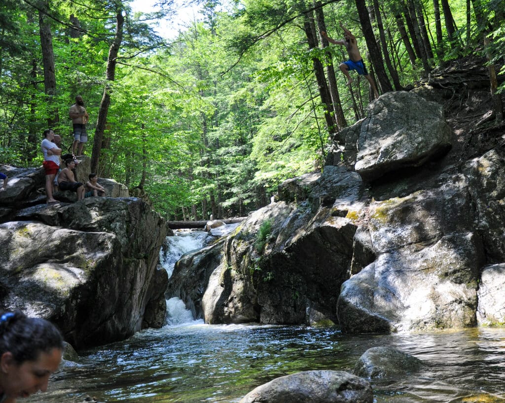
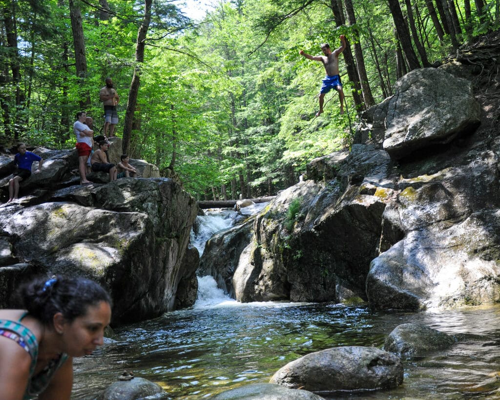
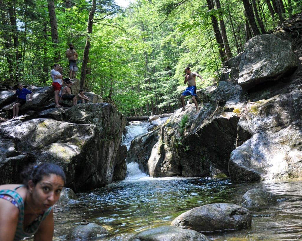
We had completed the Circle Trail but the adventure was not over. Along the 0.7 mile hike between the Circle Trail start/finish and the trail head is my personal favorite part of the hike. “Hold on Mike, there is something you like more than scrambling up the ledges, more than the wild blueberries, more than the 360 degree views found on top of both peaks”, you ask? Yes there is. Let me tell you about Emerald Pool. Emerald Pool is a crystal clear, natural pool filled with water from the mountain stream. Soaking in the pool for a minute or two is probably one of the best ways to help your legs recover after a day of hiking but there are 2 catches. 1) It is freezing cold even on the hottest summer days. If you think I’m exaggerating just watch someone else jump in and see how quickly they get out of the water. 2) The only practical way to enter the pool is by jumping in from the surrounding boulders.

READ THE DISCLAIMER: Note, the water is very deep (I have never touched the bottom) and during the summer months you will see dozens and dozens of people safely jumping off the rocks into the pool below each day. That being said, risk of injury or even death always needs to be considered prior to jumping into the pool. In addition to the obvious risk of drowning associated with any body of water that is deeper than head high, hitting other rocks on the jump down, or even slipping on the wet, slippery rocks on the way out are just some of the other risks. Please know your limits and capabilities as you and you alone are responsible for any consequences that you may incur while partaking in these type of activities.
Personally, I have assessed the risk, I know my capabilities (I would describe those capabilities here but the words needed to fully depict their greatness have not been invented yet), and I am willing to accept any potential consequences involved with me jumping in from the rocks. Note, the rock I am jumping from in the pictures below is even riskier as it is higher and you need to jump out to avoid the rocks below it and I really haven’t seen anyone else exercise this same poor judgement. Also note, a truly remarkable photo bomb from the woman in the bottom left. I considered cropping her out but this was an exceptional effort and she deserves her due.
Having been refreshed and re-energized, we completed the short hike back to the parking area. The total time on the mountain was about 7 hours and 20 mins. We packed up the car and drove back to The White Gables Inn, though made sure to stop for ice cream on the way home (multiple delicious ice cream stop options on the way).
While consuming enough calories in sugary goodness to make up for all the calories we burned (weight loss is for suckers), we had a chance to reflect on the day; We saw a moose, had a great hike, jumped in Emerald Pool, stopped for ice cream and were going to be home by 3:00. Next came the toughest part, trying to figure out how we could top it the next day.